


Pon
Wt
Śr
Czw
Pt
Sob
Ndz
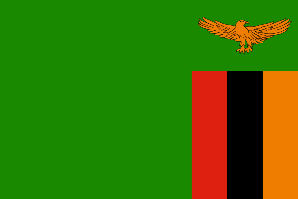
Independence day of the Republic of Zambia
Zambia, landlocked country in south-central Africa. It is situated on a high plateau and takes its name from the Zambezi River, which drains all but a small northern part of the country. Large parts of Zambia are thinly populated. Much of population is concentrated in the country’s most developed area—known as the Line of Rail—which is served by the railway linking the Copperbelt with Lusaka, the capital, and with the border town of Livingstone. Land Zambia has a long land border on the west with Angola but is divided from its neighbours to the south by the Zambezi River. To the southwest is the thin projection of Namibian territory known as the Caprivi Strip, at the eastern end of which Zambia and three of its neighbours (Namibia, Botswana, and Zimbabwe) appear to meet at a point—a “quadripoint”—although the precise nature of the meeting is contested. Man-made Lake Kariba now forms part of the river border with Zimbabwe. Zambia’s other neighbours include Mozambique to the southeast, Malawi to the east, and Tanzania to the northeast. The long border with the Democratic Republic of the Congo starts at Lake Tanganyika, crosses to Lake Mweru, and follows the Luapula River to the Pedicle, a wedge of Congolese territory that cuts deep into Zambia to give the country its distinctive butterfly shape. Westward from the Pedicle the frontier follows the Zambezi-Congo watershed to the Angolan border. Relief Most of Zambia forms part of the high plateau of this part of Africa (3,000 to 5,000 feet [900 to 1,500 metres] above sea level). Major relief features occur where river valleys and rifted troughs, some lake-filled, dissect its surface. Lake Tanganyika lies some 2,000 feet (600 metres) below the plateau, and the largest rift, that containing the Luangwa River, is a serious barrier to communications. The highest elevations occur in the east, where the Nyika Plateau on the Malawian border is generally over 6,000 feet (1,800 metres), rising to more than 7,000 feet (2,100 metres) in the Mafinga Hills. The general slope of the plateau is toward the southwest, although the drainage of the Zambezi turns eastward to the Indian Ocean. Over most of the country, ancient crystalline rocks are exposed, the product of prolonged erosion processes. In western Zambia they are overlain by younger sandy deposits, relicts of a once more-extensive Kalahari desert. In central and eastern parts of the country, downwarping of the plateau surface forms swamp- or lake-filled depressions (including Lake Bangweulu and the Lukanga Swamp); in more elevated regions, ridges and isolated hills made up of more-resistant rocks punctuate otherwise smooth skylines. The oldest rocks in the country are volcanics and granites of the Bangweulu block in the northeast. These are 2.5 billion years and older and have been unaffected by orogenic processes since Precambrian times (about 4 billion to 540 million years ago). This old structure is partly covered by ancient sedimentary rocks, and together they constitute the basement complex. Sedimentaries of the Katangan Complex (about 620 million years old) are extensive in the central areas, and mineralization of these rocks is the basis of Zambia’s mining industry. Later sedimentary rocks of the Karoo (Karroo) System filled rifted troughs in the plateau surface, some of which, as in the Luangwa and middle Zambezi valleys, have been partially re-excavated. Coal seams occur in Karoo rocks to the north of Lake Kariba. These structural troughs are ancient features. Younger rifts in the north, part of the East African Rift System, are occupied by Lakes Mweru and Tanganyika. Karoo and older sedimentaries are also found in the west, buried under the predominantly sandy deposits of the Kalahari System. Drainage The continental divide—between the Congo River drainage, which flows to the Atlantic Ocean, and that of the Zambezi, which drains into the Indian Ocean—runs along the border shared by Zambia and the Democratic Republic of the Congo west of the Pedicle and then northeastward to the border with Tanzania. Both the Luapula (which drains the Bangweulu basin into Lake Mweru) and Lake Tanganyika are tributary to the Congo. The rest of the country lies within the Zambezi basin, the river itself rising in northwestern Zambia and circling through Angola before traversing the sandy plains of western Zambia. At Victoria Falls it drops some 300 feet (90 metres) into a milewide chasm at the head of the gorge leading down to Lake Kariba and the troughlike middle part of its valley. It has two main tributaries in Zambia. Rising on the Copperbelt, the Kafue River drains the Lukanga Swamp and Kafue Flats before an abrupt descent to the Zambezi. The Luangwa River, mostly confined within its rift trough, is quite different. The Bangweulu Swamps and the Kafue Flats are wetlands of international ecological importance. Soils Zambia is divided into three main agroecological regions based primarily upon annual precipitation; there is further variation within regions based on factors such as soil type, temperature, precipitation, and elevation. The first region includes portions of the southwestern corner of the country, as well as the country’s major valleys, such as the Gwembe, Zambezi, and Luangwa valleys. This region is the driest and most prone to drought, and its soils contain low levels of organic matter, low nutrient reserves, and high acidity levels. The second region spans the central part of the country and is divided into two subregions: the degraded plateau of the southeast, south-centre, and southwest and the Kalahari Sands and the Zambezi floodplain in the west. Soils of the Kalahari Sands have little agricultural potential and are mainly under woodland. The third region is situated in the northern part of the country; its soils tend to be highly weathered and leached, with a low pH. Climate of Zambia Although Zambia lies within the tropics, its climate is modified by the altitude of the country and is generally favourable to human settlement and comfort. The marked seasonal pattern of precipitation is caused by the north and south movement of the intertropical convergence zone (ITCZ), which shifts with the Sun. In January the ITCZ is in its southernmost position, and the rainy season is at its peak; by June it has moved north, and the weather is dry. Summer rains reduce the high temperatures that might be expected at this time. Precipitation (concentrated in just five months) varies according to agroecological region but generally comes in storms with heavy raindrops that lead to a hard soil surface and surface erosion. The driest region receives annual precipitation of less than 30 inches (800 mm), while precipitation in the wettest region normally exceeds 40 inches (1,000 mm); precipitation occasionally exceeds 55 inches (1,400 mm) in the northeast. Temperature is modified by elevation, with the highest mean daily maximum temperatures occurring in the Luangwa valley and the southwest. The coolest area overall is the high Nyika plateau, in the northeast on the border with Malawi. During the cold months (June and July), the area west of the Line of Rail is coolest, with mean minimum temperatures mostly below the mid-40s F (about 7 °C). Sesheke, in the southwest, has frost on an average of 10 days per year. Average annual hours of sunshine range from more than 3,000 in the southwest to less than 2,600 on the eastern border. Winds are predominantly easterly-southeasterly, although in the rainy season winds blow from the northwest and north. Wind speeds are rarely strong enough to cause damage. Although the major contrast is between the rainy season and the drier months, three seasons may be identified. The warm wet season lasts from November until April, when temperatures range between the high 60s and low 80s F (low to mid-20s C) and during which time the country receives the vast majority of its annual precipitation. The movement into Zambia of the moist Congo air mass from the northwest heralds the start of the rains, in the north usually in early November and toward the end of the month around Lusaka. The change from dry to wet conditions is transitional rather than abrupt. December and January are the wettest months. Cloud cover lowers maximum temperatures but also limits radiative heat loss at night, so that minimum temperatures are kept relatively high. Relative humidity values are high, typically 95 percent in early morning but declining to 60–70 percent by midafternoon. Sunshine is surprisingly frequent; Lusaka averages six hours of sunshine per day in January. Precipitation declines rapidly in April with the northward movement of the ITCZ. The cool dry season lasts from May until August, with maximum temperatures ranging from the high 50s F (mid-10s C) to the low 80s F (mid-20s C); morning and evening temperatures may be significantly lower. The Sun is overhead in the Northern Hemisphere, so temperatures are low; July is usually the coldest month. Clear skies allow maximum heat radiation and result in especially low temperatures on calm nights, with occasional ground frost occurring in sheltered valleys. The hot dry season lasts from September until October, when maximum temperatures range from the low 80s F (mid-20s C) to the mid-90s F (mid-30s C). This is a period of rapidly rising temperatures; just two months separate July, the coldest month, and October, usually the hottest (although if the rains are delayed November can be hotter). Usually by mid-October cooler oceanic air moves in, leading to increasing humidity and cloud formation. High temperatures and increasing humidity make this one of the least comfortable times of the year, although the first rains wash away dry-season dust. More … Score: https://www.britannica.com/place/Zambia
Czytaj więcej2026/10/24
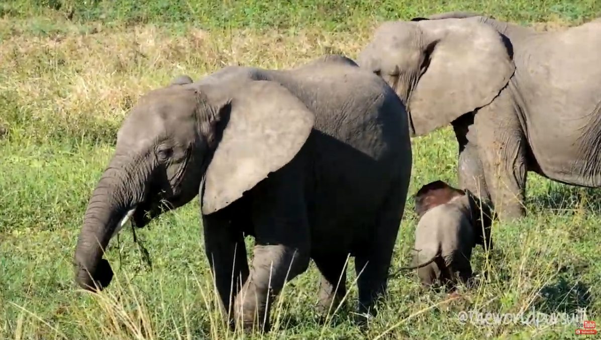
WELCOME TO ZAMBIA
We traveled around Zambia through its top parks to see just how beautiful the country really is.
Czytaj więcej2026/10/23
Spanish Tourism | Tourist information on Spain
Spain's official tourism website · Discover our destinations · Discover our destinations · Not to be missed · Spain Travel Guide, · Other ideas for your trip · Extend ..
Czytaj więcej2026/10/14

Guinea Ecuatorial Página Web Institucional del Gobierno
La DBGI actualmente es un órgano dependiente del Ministerio de Información, Prensa y Radio. Los reporteros de www.guineaecuatorialpress.com, pertenecientes a la ...
Czytaj więcej2026/10/14
The Fijian Government's Official Website
Ministry of Communications - Official Fijian Government website with information about departments, ministries, news briefs and press releases.
Czytaj więcej2026/10/12
National Day of the Kingdom of Spain
La Fiesta Nacional de España o Día de la Hispanidad (Festa Nacional d'Espanya, en catalán; Festa Nacional de España, en gallego; Espainiako Jai Nazionala, en vasco) conmemora la efeméride histórica del Descubrimiento de América por parte de España. La celebración tiene lugar cada 12 de Octubre, donde se celebra un desfile militar en la Plaza de Colón de Madrid en el que asisten Su Majestad el Rey junto a la Familia Real y los representantes más importantes de todos los poderes del Estado Español, además de la mayoría de los presidentes de las autonomías españolas. El Descubrimiento de América fue de trascendental importancia para España, iniciando un periodo de proyección lingüística, cultural y económica en América. Todo ello ocurrió en una época donde estaba finalizando el proceso de construcción del Estado actual, con la integración de los diferentes reinos peninsulares en un sólo y único reino. Cristóbal Colón, en representación de los Reyes Católicos de España, realizó cuatro famosos viajes o expediciones desde Europa a América en 1492, 1493, 1498 y 1502. En el primero de ellos llegó a América el 12 de Octubre de 1492, a una isla de las Bahamas llamada Guanahani, cuya exacta localización aún hoy se discute. En el tercer viaje llegó a territorio continental en la actual Venezuela.A partir del tercer viaje de Cristóbal Colón, descubrimientos y conquista progresaron conjuntamente. Durante los veinte años que separan 1499 de 1519, cuando empieza la empresa magallánica, tuvieron lugar los llamados «los viajes menores o andaluces», capitulados por la corona con otros nautas quebrando el discutido monopolio colombino. En el primero de estos participó Américo Vespucio a quien se ha atribuido ser el primer europeo en proponer que las tierras a las que Colón había llegado no eran en realidad parte de Asia, sino de un continente desconocido para los europeos. Puedes leer más Score: https://www.12octubre.es/ Spain, country located in extreme southwestern Europe. It occupies about 85 percent of the Iberian Peninsula, which it shares with its smaller neighbour Portugal. Spain is a storied country of stone castles, snowcapped mountains, vast monuments, and sophisticated cities, all of which have made it a favoured travel destination. The country is geographically and culturally diverse. Its heartland is the Meseta, a broad central plateau half a mile above sea level. Much of the region is traditionally given over to cattle ranching and grain production; it was in this rural setting that Miguel de Cervantes’s Don Quixote tilted at the tall windmills that still dot the landscape in several places. In the country’s northeast are the broad valley of the Ebro River, the mountainous region of Catalonia, and the hilly coastal plain of Valencia. To the northwest is the Cantabrian Mountains, a rugged range in which heavily forested, rain-swept valleys are interspersed with tall peaks. To the south is the citrus-orchard-rich and irrigated lands of the valley of the Guadalquivir River, celebrated in the renowned lyrics of Spanish poets Federico García Lorca and Antonio Machado; over this valley rises the snowcapped Sierra Nevada. The southern portion of the country is desert, an extension of the Sahara made familiar to Americans through the “spaghetti western” films of the 1960s and early ’70s. Lined with palm trees, rosemary bushes, and other tropical vegetation, the southeastern Mediterranean coast and the Balearic Islands enjoy a gentle climate, drawing millions of visitors and retirees, especially from northern Europe.Spain’s countryside is quaint, speckled with castles, aqueducts, and ancient ruins, but its cities are resoundingly modern. The Andalusian capital of Sevilla (Seville) is famed for its musical culture and traditional folkways; the Catalonian capital of Barcelona for its secular architecture and maritime industry; and the national capital of Madrid for its winding streets, its museums and bookstores, and its around-the-clock lifestyle. Madrid is Spain’s largest city and is also its financial and cultural centre, as it has been for hundreds of years. The many and varied cultures that have gone into the making of Spain—those of the Castilians, Catalonians, Lusitanians, Galicians, Basques, Romans, Arabs, Jews, and Roma (Gypsies), among other peoples—are renowned for their varied cuisines, customs, and prolific contributions to the world’s artistic heritage. The country’s Roman conquerors left their language, roads, and monuments, while many of the Roman Empire’s greatest rulers were Spanish, among them Trajan, Hadrian, and Marcus Aurelius. The Moors, who ruled over portions of Spain for nearly 800 years, left a legacy of fine architecture, lyric poetry, and science; the Roma contributed the haunting music called the cante jondo (a form of flamenco), which, wrote García Lorca, “comes from remote races and crosses the graveyard of the years and the fronds of parched winds. It comes from the first sob and the first kiss.” Even the Vandals, Huns, and Visigoths who swept across Spain following the fall of Rome are remembered in words and monuments, which prompted García Lorca to remark, “In Spain, the dead are more alive than the dead of any other country in the world.” In 1492, the year the last of the Moorish rulers were expelled from Spain, ships under the command of Christopher Columbus reached America. For 300 years afterward, Spanish explorers and conquerors traveled the world, claiming huge territories for the Spanish crown, a succession of Castilian, Aragonese, Habsburg, and Bourbon rulers. For generations Spain was arguably the richest country in the world, and certainly the most far-flung. With the steady erosion of its continental and overseas empire throughout the 18th and 19th centuries, however, Spain was all but forgotten in world affairs, save for the three years that the ideologically charged Spanish Civil War (1936–39) put the country at the centre of the world’s stage, only to become ever more insular and withdrawn during the four decades of rule by dictator Francisco Franco. Following Franco’s death in 1975, a Bourbon king, Juan Carlos, returned to the throne and established a constitutional monarchy. The country has been ruled since then by a succession of elected governments, some socialist, some conservative, but all devoted to democracy. Land Spain is bordered to the west by Portugal; to the northeast it borders France, from which it is separated by the tiny principality of Andorra and by the great wall of the Pyrenees Mountains. Spain’s only other land border is in the far south with Gibraltar, an enclave that belonged to Spain until 1713, when it was ceded to Great Britain in the Treaty of Utrecht at the end of the War of the Spanish Succession. Elsewhere the country is bounded by water: by the Mediterranean Sea to the east and southeast, by the Atlantic Ocean to the northwest and southwest, and by the Bay of Biscay (an inlet of the Atlantic Ocean) to the north. The Canary (Canarias) Islands, in the Atlantic Ocean off the northwestern African mainland, and the Balearic (Baleares) Islands, in the Mediterranean, also are parts of Spain, as are Ceuta and Melilla, two small enclaves in North Africa (northern Morocco) that Spain has ruled for centuries. Relief Spain accounts for five-sixths of the Iberian Peninsula, the roughly quadrilateral southwestern tip of Europe that separates the Mediterranean Sea from the Atlantic Ocean. Most of Spain comprises a large plateau (the Meseta Central) divided by a mountain range, the Central Sierra (Sistema Central), which trends west-southwest to east-northeast. Several mountains border the plateau: the Cantabrian Mountains (Cordillera Cantábrica) to the north, the Iberian Cordillera (Sistema Ibérico) to the northeast and east, the Sierra Morena to the south, and the lower mountains of the Portuguese frontier and Spanish Galicia to the northwest. The Pyrenees run across the neck of the peninsula and form Spain’s border with France. There are two major depressions, that of the Ebro River in the northeast and that of the Guadalquivir River in the southwest. In the southeast the Baetic Cordillera (Sistema Penibético) runs broadly parallel to the coast to merge with the mountains of the Iberian Cordillera. Along the Mediterranean seaboard there are coastal plains, some with lagoons (e.g., Albufera, south of Valencia). Offshore in the Mediterranean, the Balearic Islands are an unsubmerged portion of the Baetic Cordillera. The Canary Islands in the Atlantic are of volcanic origin and contain the highest peak on Spanish territory, Teide Peak, which rises to 12,198 feet (3,718 metres) on the island of Tenerife. Spain has some of the oldest as well as some of the youngest rocks of Europe. The entire western half of Iberia, with the exception of the extreme south, is composed of ancient (Hercynian) rocks; geologists refer to this Hercynian block as the Meseta Central. It constitutes a relatively stable platform around which younger sediments accumulated, especially on the Mediterranean side. In due course these sediments were pushed by major earth movements into mountain ranges. The term meseta is also used by geographers and local toponymy to designate the dominating relief unit of central Iberia. As a result, the Meseta Central defined by relief is subdivided by geology into a crystalline west (granites and gneisses) and a sedimentary east (mainly clays and limestones). The northern Meseta Central, which has an average elevation of 2,300 feet (700 metres), corresponds to the tablelands, or plateau, of Castile and León, although it is in fact a basin surrounded by mountains and drained by the Douro (Duero) River. The southern Meseta Central (the Meseta of Castile–La Mancha) is some 330 feet (100 metres) lower. Its relief is more diverse, however, owing to heavy faulting and warping caused by volcanic activity around the Calatrava Plain and to two complex river systems (the Guadiana and the Tagus) separated by mountains. Its southern plains rise gradually to the Sierra Morena. The southeastern side of this range drops almost vertically by more than 3,300 feet (1,000 metres) to the Guadalquivir depression. Dividing the northern and southern Mesetas are the Central Sierras, one of the outstanding features of the Iberian massif. Their highest points—Peñalara Peak at 7,972 feet (2,430 metres) and Almanzor Peak at 8,497 feet (2,590 metres)—rise well above the plains of the central plateau. In contrast, the granitic Galician mountains, at the northwestern end of the Hercynian block, have an average elevation of only 1,640 feet (500 metres), decreasing toward the deeply indented (ria) coast of the Atlantic seaboard. Part of Alpine Europe, the Pyrenees form a massive mountain range that stretches from the Mediterranean Sea to the Bay of Biscay, a distance of some 270 miles (430 km). The range comprises a series of parallel zones: the central axis, a line of intermediate depressions, and the pre-Pyrenees. The highest peaks, formed from a core of ancient crystalline rocks, are found in the central Pyrenees—notably Aneto Peak at 11,168 feet (3,404 metres)—but those of the west, including Anie Peak at 8,213 feet (2,503 metres), are not much lower. The mountains fall steeply on the northern side but descend in terraces to the Ebro River trough in the south. The outer zones of the Pyrenees are composed of sedimentary rocks. Relief on the nearly horizontal sedimentary strata of the Ebro depression is mostly plain or plateau, except at the eastern end where the Ebro River penetrates the mountains to reach the Mediterranean Sea. More … Score: https://www.britannica.com/place/Spain
Czytaj więcej2026/10/12


Filmy promujące
Promuj regiony
Promocja regionów obejmie swoim zasięgiem zarówno region, Polskę, jak i świat. Zaplanowane działania promocyjne pozwolą dotrzeć do mieszkańców regionu - potencjalnych konsumentów oraz inwestorów w kraju i za granicą.
Panama 2019 | 4K | must see places | travel guide
A clip of our Panama trip in april 2019. The journey was planned as followed: We arrived in Panama City and took the Night Bus to Almirante to get to 0:41 Bocas del Torro
Bethlehem, Palestine: Church of the Nativity
More info about Rick's travels to Palestine: http://www.ricksteves.com/watch-read-... No longer just the little town of Christmas-carol fame, Bethlehem is a leading Palestinian city. Its skyline is a commotion of both crescents and crosses — a reminder that the town, while now mostly Muslim, still has many Christians.

Zapisz się do biuletynu dyplomatycznego


